
Series: History of Kinnaur, Himachal Pradesh, India
Phase 5: Modern Era — Part 24 of 30
This article appears within a continuing historical series that follows the western Himalayas into the modern era. With the end of princely rule and the integration into independent India, long-standing social and political patterns were reconfigured. This phase examines how development, state formation, and memory interact with inherited landscapes, shaping contemporary life while carrying forward echoes of the past.
Along the Sutlej: A Morning on the Old Hindustan-Tibet Road
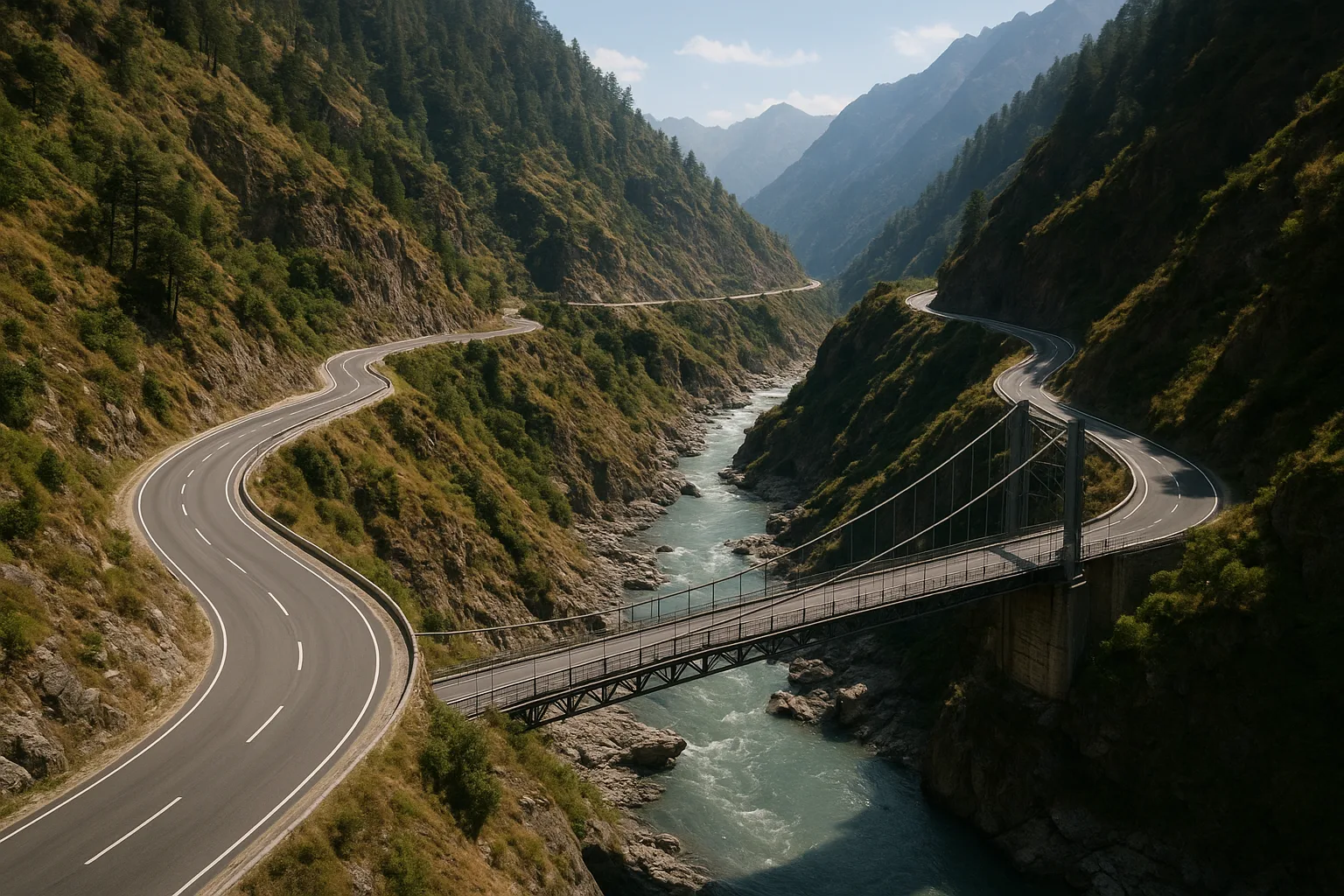
The sun rises late in the gorges of Kinnaur. Mist clings to the edges of the Sutlej, and the first trucks—carrying apples and cement—crawl around hairpin bends cut into mountainsides. It is a scene impossible to imagine a century ago, when these river valleys were linked not by roaring engines, but by silence and the slow tread of mule caravans. Today, the sound of tires on blacktop cuts through the landscape, a testament to how roads have redrawn Kinnaur’s connection with the world.
Land of Passes and Pathways: Kinnaur Before the Road
Long before asphalt and dynamite, Kinnaur’s story was written in footpaths. Oral traditions speak of ancient trails beside the Sutlej, Spiti, and Baspa rivers, where traders and pilgrims traced dangerous routes between India and Tibet. In folk memory, these were not only ways through the mountains—they were arteries of faith, commerce, and kinship. The people of Kinnaur, divided into lower, middle, and upper regions, relied on local knowledge to cross high passes like Shipki La and Rupin Pass, defying both altitude and isolation.
Early settlements clustered near river confluences and terraced fields, with small hamlets surrounded by apple orchards and barley fields. Polytheistic belief systems—honoring deities like Dabla and Chitkul Devi—shaped local festivals and rituals, while Buddhist influences filtered in from the north. Yet, the mountains themselves remained the most formidable boundary, keeping Kinnaur both connected and apart.
Trade, Empires, and the Coming of Roads
By the late medieval era, Kinnaur’s trails had become vital links in the trans-Himalayan trade. Caravans brought salt and wool from Tibet; grains, spices, and cotton flowed up from the plains. The early chronicles of the region, such as the 19th-century Settlement Reports and the Gazetteer of the Simla Hill States, describe how these seasonal routes shaped not only commerce, but also diplomacy and local autonomy. Kinnaur’s strategic position at the crossroads of empires—between Ladakh, Tibet, and the princely states of Bushahr and Rampur—meant that roads were as much about power as about passage.
Yet, as the colonial British extended their gaze northward in the 19th century, the need for a more reliable route became pressing. The legendary Hindustan-Tibet Road was conceived—not as a highway for locals, but as a grand imperial artery to project British influence deep into the Himalayas. Construction began in the 1850s, with laborers hacking a precarious track through cliffs and scree. For decades, progress was slow and dangerous; landslides and avalanches were frequent reminders of the mountains’ indifference to human ambition.
Colonial Ambition and Local Realities
By the early 20th century, the Hindustan-Tibet Road had reached Reckong Peo and beyond, but it remained a seasonal lifeline at best. In the accounts of British officers and Indian administrators, one hears persistent frustration: the road was often cut off by snow or blocked by boulders. For Kinnauris, the road brought new risks and opportunities. The arrival of British engineers and Nepali laborers disrupted old patterns of land use and migration. Some local rulers, like the Bushahr rajas, leveraged the road to consolidate authority and control trade tolls. Others watched uneasily as outsiders became a permanent feature of Kinnaur’s social landscape.
Yet, even as the road changed the region, it remained incomplete. In winter, villages like Chitkul or Nako could be cut off for months. Oral histories from elders in Sangla and Kalpa still recall the days when young men trekked for days to Rampur or Shimla to trade or seek work, carrying salt and wool in heavy baskets. The road was a bridge, but never a guarantee.
After Independence: The Road to Transformation
The decades after 1947 marked a new chapter in Kinnaur’s relationship with roads and connectivity. With the creation of Himachal Pradesh as a full-fledged state, and the growing importance of border security after the 1962 Sino-Indian War, the Indian government invested heavily in infrastructure. The Border Roads Organisation (BRO) took over maintenance and expansion of the Hindustan-Tibet Road—now National Highway 5—using new technologies to blast tunnels and stabilize slopes. Bridges replaced ferries; landslide-prone stretches were reinforced with concrete and steel.
Modern infrastructure brought dramatic changes. Apple orchards flourished as trucks could now carry fresh produce to distant markets. Schools, hospitals, and government offices became accessible year-round. The population grew more mobile, with young people traveling to Shimla, Chandigarh, and beyond for education and work. Yet, for all its promise, the new connectivity also brought anxieties about environmental degradation, loss of cultural identity, and the influx of outsiders. The scars of road-widening—raw edges on the mountainside, the memory of floods and landslides—remind Kinnauris daily of the price of progress.
Connectivity, Communication, and the Digital Leap
As the 21st century unfolded, Kinnaur’s infrastructure story expanded beyond roads. Mobile towers now dot the ridgelines, and high-speed internet has begun to reach even the most remote villages. Government schemes have linked hamlets to electricity grids and piped water, while new bridges span the Sutlej and Baspa. The old postal routes, once served by runners who braved blizzards and bears, have given way to courier services and WhatsApp messages. Yet, for many, the memory of isolation is never far away. During the 2013 cloudburst and floods, the region was cut off for days, a stark reminder that technology cannot yet conquer the Himalayas’ volatility.
The arrival of connectivity has also brought new challenges. Traditional occupations—shepherding, weaving, subsistence farming—compete with wage labor on road crews and in construction. Young people are drawn to the promise of city life, even as the elders worry about the erosion of language, ritual, and memory. The road is no longer just a path through the mountains, but a crossroads of identity and aspiration.
Enduring Roots: The Mountain Shapes the Modern
In every generation, the people of Kinnaur have negotiated what it means to be both of the mountains and connected to the world beyond. Roads and infrastructure have transformed daily life, but the region’s deep sense of place endures. Old temples still watch over new bridges; festivals like Phulaich and Losar blend ancient ritual with modern celebration. The sound of trucks along the highway mixes with the chanting of priests in village shrines. The history of Kinnaur’s roads—written in sweat, stone, and ambition—reminds us that progress is never a straight line, but a winding journey shaped by landscape and memory alike.
As we move forward in this series, the next chapter will focus on how modernization and tourism are reshaping Kinnaur’s economy, society, and sense of self—while the mountains continue to loom, silent but ever-present, above the road.
Previous: Border Sensitivity and Strategic Importance of Kinnaur
Next: Apple Orchards and Economic Change in Kinnaur