Series: History of Una, Himachal Pradesh, India
Phase 1: Ancient & Early Roots — Part 2 of 30
This article is part of a broader historical series exploring the earliest layers of human presence in the western Himalayas. Beginning with landscape, belief, and early patterns of movement and settlement, the series traces how communities adapted to mountainous environments long before formal states or written records emerged. These foundational centuries shaped cultural memory, local traditions, and relationships with the land that would endure through later periods of change.
The Dawn Over Swan: A Scene at the River’s Edge
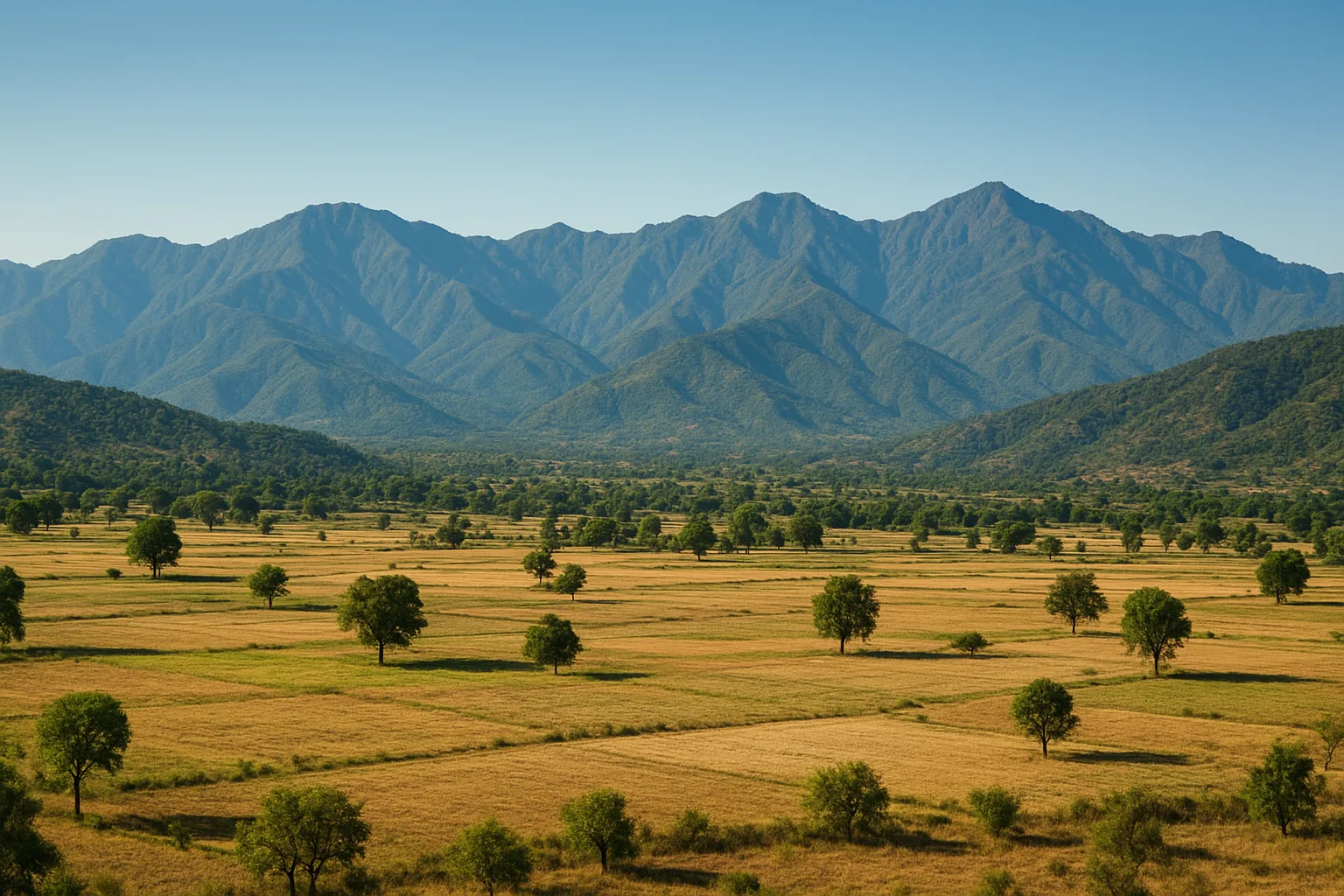
Picture a misty morning centuries ago. The Swan River glimmers beneath the pale sky, its waters winding serenely past thickets of bamboo and clusters of wild grasses. Traders lead bullock carts along the pebbled bank, their wheels heavy with salt and spices, while weary travelers glance up at the low, rolling hills that mark the threshold to the Himalayan foothills. To the south: the fertile Punjab plains. To the north: the forested ridges and high valleys of what is now Himachal Pradesh. Here, at the confluence of land and culture, lies Una—a place shaped, above all, by its geography.
The Landscape: A Crucible of Contrasts
Unlike the soaring peaks further north, Una’s hills are gentle—yet decisive. The Shivalik range, a band of ancient, low-elevation mountains, forms a natural divide. These hills are the first real rise from the plains, a green barricade that both invites and challenges newcomers. The Swan, Sutlej, and their tributaries carve deep channels through the landscape, creating fertile valleys and fording points that have, for millennia, dictated where people travel, settle, and trade.
This terrain is neither fully hill nor plain. Its ambiguity is its power. Over centuries, Una’s geography has made it a place of movement—a passage, a meeting ground, a contested threshold.
Ancient Corridors: Prehistoric Pathways and Early Settlements
Long before written history, Una’s valleys and riverbanks were home to early humans. Archaeological finds from the broader Shivalik region—hand axes, scrapers, and microliths—reveal that Paleolithic and Mesolithic communities traversed this land. The rivers, rich with fish and flanked by wild fruit, drew hunter-gatherers seeking sustenance and safety.
As agricultural societies emerged in the Indus Valley to the west and the Ganga plains to the east, Una’s location became ever more strategic. It was a natural corridor, linking fertile lowlands to resource-rich hills. Early trade, migration, and even local conflicts left their traces in the stones and soil, hinting at a region that was never isolated, but always connected.
Empires at the Edge: The Age of Mahajanapadas and Mauryas
By the 6th century BCE, powerful kingdoms—Mahajanapadas—competed for territory across northern India. The region that now includes Una was often claimed by the Kuru and Trigarta states. To the north, the hill principalities kept a wary eye on their lowland neighbors. Rivers and ridges provided defense, but also routes for armies and caravans.
When the Mauryan Empire extended its reach in the 3rd century BCE, Emperor Ashoka’s emissaries crossed through Una’s valleys. The Buddhist influence that followed left faint but significant marks: legends of monks journeying north, traces of ancient stupas, and the spread of new ideas through mountain passes. Geography ensured that Una was never just a backwater—it was a conduit for imperial ambition and spiritual exchange.
Medieval Crossroads: Rajput Forts and Mughal Marches
The medieval period brought new opportunities—and dangers. As Rajput clans established hill states like Kangra and Jaswan, Una became a buffer zone. Forts rose on hilltops, controlling vital fords and passes. The ridges that once sheltered villagers now served as lookout points for armies on the move.
In the 16th and 17th centuries, Mughal contingents marched along the river valleys, seeking to assert control over fractious hill rajas. The Swan River, a lifeline for locals, also became a logistical artery for imperial troops. Records from Akbar’s court mention the challenges of maneuvering through the region’s unpredictable terrain—landslides in the rains, treacherous mud, and the ever-present risk of ambush in dense sal forests.
- Rajput rulers like Raja Purab Chand of Jaswan built fortifications to secure these routes.
- Travelers like the Persian chronicler Abu’l-Fazl described the landscape’s beauty and danger in equal measure.
These centuries forged Una’s reputation as both a prize and a puzzle for would-be rulers.
Sikh, British, and Modern Frontiers: New Roads, New Realities
The late 18th and early 19th centuries saw the rise of the Sikh Empire, with Maharaja Ranjit Singh’s armies pushing the boundaries of Punjab. Once again, Una’s rivers and ridges became frontlines. The Sikh annexation of Kangra in 1809 drew Una into new networks of power and commerce. Markets flourished, and new roads began to thread through the hills, further cementing Una’s status as a gateway.
The British, recognizing Una’s strategic value, built administrative outposts and improved infrastructure. The introduction of postal routes and, later, the railway in the nearby plains, tied Una ever more tightly to the broader colonial economy. Censuses and gazetteers from the British Raj speak of a tehsil bustling with traders, farmers, and government agents shuttling between the hills and the Punjab.
People in Motion: Migration, Trade, and Cultural Exchange
Throughout its history, Una has been defined by movement. Rajput warriors on horseback, Buddhist monks with their scriptures, Sikh merchants with bales of cloth, and British officials with ledgers—all passed through, shaping and being shaped by the land.
The rivers brought not just water, but stories and skills. Seasonal migrations from hill villages to the plains for work or festivals were common, and marriage alliances often crossed the ridges. The local dialect, Pahari, carries echoes of Punjabi and Hindi, a linguistic testament to centuries of cultural blending.
Even today, the weekly markets (mandis) of Una echo with voices from both sides of the hills, a living reminder that the geography which once separated is now a bridge.
The Geography of Identity: Una’s Enduring Role
What does it mean to be a gateway? For Una, geography is not just backdrop, but destiny. The rivers and ridges that shaped the region’s history continue to define its future. As Himachal Pradesh’s southwestern sentinel, Una remains the first embrace of the hills for countless travelers, pilgrims, and migrants.
Modern highways and railways follow the same ancient paths, and the Swan River still glistens in the morning sun. The thresholds of Una—both physical and cultural—invite us to consider how landscapes mold history, and how history, in turn, is written on the land.
In the next post in this series, we’ll explore the early communities who made Una their home, and how their choices echo through the ages. For now, as evening falls over the hills, one thing is clear: Una’s geography is not just a map, but a story—one that continues to unfold, day by day, along the gateway to the hills.
Previous: Ancient Settlements of the Una Plains Region
Next: Early Agrarian Communities of Una