Series: History of Sirmaur, Himachal Pradesh, India
Phase 1: Ancient & Early Roots — Part 2 of 30
This article is part of a broader historical series exploring the earliest layers of human presence in the western Himalayas. Beginning with landscape, belief, and early patterns of movement and settlement, the series traces how communities adapted to mountainous environments long before formal states or written records emerged. These foundational centuries shaped cultural memory, local traditions, and relationships with the land that would endure through later periods of change.
The Dawn Over Morni Hills
The first rays of sunlight spill through a gap in the Morni Hills, illuminating a valley shrouded in mist. The air is cool, even in late summer. Below, a small group of early settlers stirs beside a stream, their shelters clustered near the water’s edge. The river’s song is a constant companion, as timeless as the rocks themselves. This is Sirmaur: land of steep ridges, dense forests, and secret valleys—a realm where the land has always spoken first, and people have learned to listen.
Boundaries Forged by Nature
Sirmaur’s geography is a study in contrasts. To the north, the snowy Dhauladhar peaks stand sentinel; to the south, the land relaxes into the plains of Haryana. Jagged ridges, deep-cut gorges, and meandering rivers create natural boundaries—barriers as effective as any fortress wall. Even before written records, these features defined how people moved, settled, and interacted.
Early communities were shaped by isolation and connection in equal measure. The Giri and Tons rivers carved lifelines through the hills, their fertile banks nourishing crops and drawing wildlife. Dense forests—deodar, pine, and oak—once cloaked the slopes, providing shelter and sustenance but also concealing dangers. These natural corridors and barriers would shape every aspect of Sirmaur’s development, from the location of villages to the evolution of trade and warfare.
The Origin of Settlement Clusters
Long before palaces or temples, Sirmaur’s earliest settlers read the land like a living map. Archaeological finds near Paonta Sahib and Rajban hint at Neolithic camps, where small groups gathered near water sources and fertile terraces. The geography dictated more than survival—it created a mosaic of micro-communities, often separated by steep valleys or forested ridges.
These physical divides fostered unique dialects, customs, and kinship ties. Oral traditions passed through generations still echo this patchwork, with each village tracing its roots to a particular spring, grove, or sacred outcrop. The town of Nahan, perched atop a ridge, would much later become a hub precisely because it overlooked these vital arteries—its geography a silent partner in its rise.
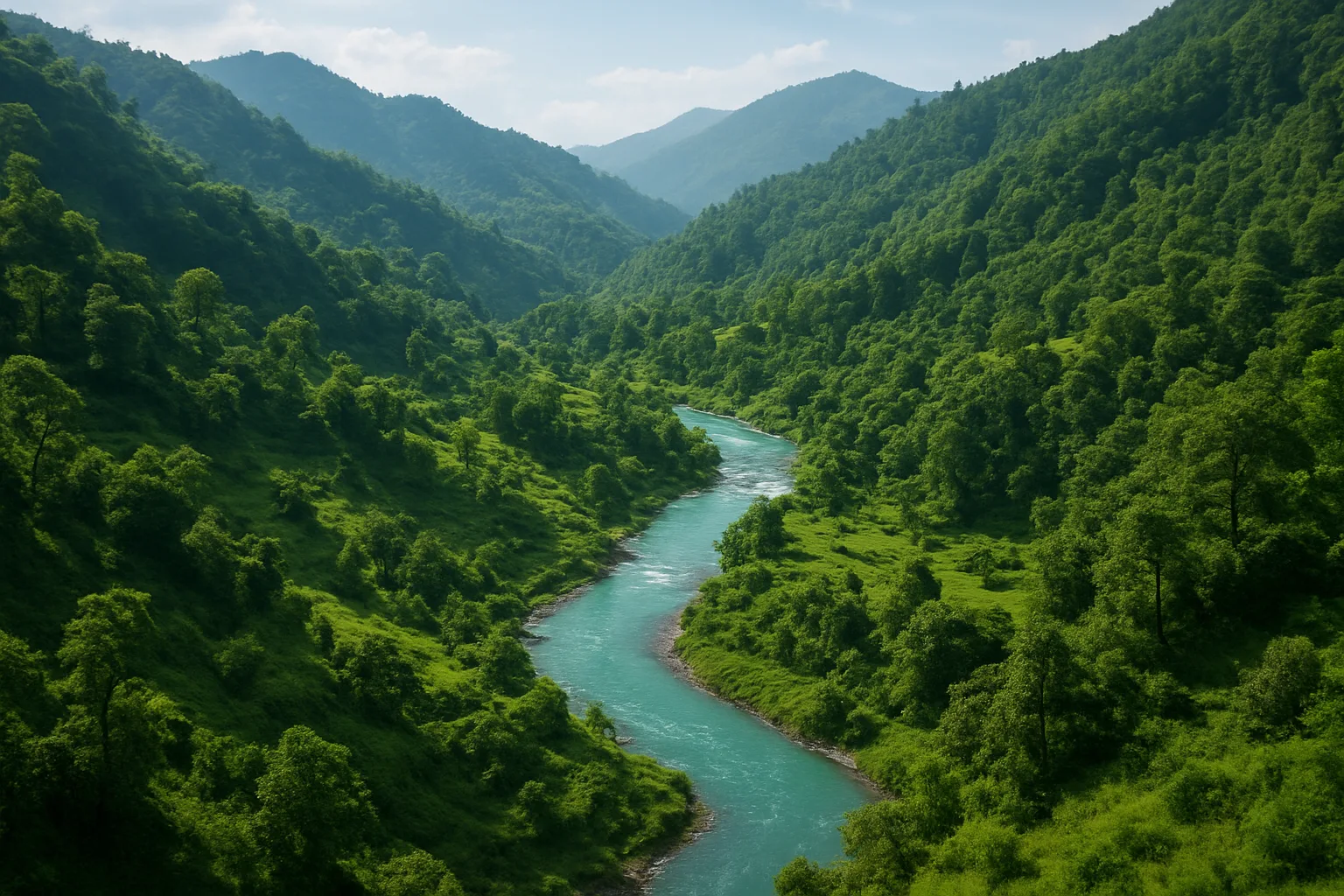
Rivers as Lifeblood and Boundary
For the earliest Sirmauris, rivers were more than water—they were gods, guardians, and guides. The Giri flows from the highlands, its course defining the eastern reaches. The Yamuna, marking the region’s southern edge, provided not only fertile floodplains but also a shifting border with neighboring kingdoms. These rivers could be blessings or barriers, alternately linking communities or keeping them apart as seasonal floods redrew the landscape.
Over centuries, river valleys became trade routes. Salt, grains, and forest products moved along these ancient highways, connecting Sirmaur to distant plains and Himalayan interiors. Folklore still tells of traders and pilgrims braving swollen waters or hidden fords, their journeys shaping the culture and economy of the region.
Forest, Rock, and Sanctuary
The forests of Sirmaur have always harbored more than wildlife. In times of conflict, families retreated deep into the trees, finding refuge among the rocks and hidden glades. These forests were also home to sages and hermits, whose ashrams became early centers of learning and spirituality. The legend of Sage Vyasa meditating in the hills near Renuka Lake is woven into local memory, lending sacredness to the geography.
Rocky cliffs and caves provided shelter from both human and natural threats. Over time, some of these sites became shrines—places where the line between nature and the divine blurred. The very land was seen as alive, its features invested with stories and significance that bound communities together.
Hill Forts and the Rise of Early Chiefs
As agriculture and trade took root, the need for protection grew. Geography again dictated strategy: hilltops and ridges offered natural vantage points, and early forts took shape atop these heights. The remnants of ancient fortifications at Kamrau and Shamshergarh suggest that even before the rise of the Sirmaur dynasty, local chieftains understood the value of elevation and defense.
These early chiefs—known in tradition as thakurs or ranas—often ruled over small, fiercely independent domains. Their authority was as much a product of their control over difficult terrain as of any inherited title. In the chronicles of later Sirmaur rulers, these hill forts are remembered as the seeds from which a kingdom would grow, their locations chosen as much by the lay of the land as by human ambition.
Trade, Pilgrimage, and the World Beyond
Despite its ruggedness, Sirmaur was never wholly isolated. Ancient paths threaded through the hills, marked by cairns or sacred stones. Some led to the plains, others to the upper Himalayas. Pilgrims journeyed to Renuka Lake—believed to be the oldest lake in Himachal Pradesh—while traders carried salt, wool, and medicinal herbs to distant bazaars.
These routes were dangerous, but they fostered exchange. Ideas, stories, and technologies filtered in, carried by merchants and mendicants. Over time, Sirmaur’s valleys became meeting grounds for different cultures—Rajputs, Gaddis, Gujjars—each leaving traces in language, dress, and custom. The region’s geography, once a barrier, became a conduit for transformation.
The Legacy of Living With the Land
The story of Sirmaur’s early life is inseparable from its geography. For millennia, the land dictated where people lived, how they grew their food, whom they fought, and what they believed. Even as later dynasties rose to power—a topic we will explore in the next post—the imprint of hills and rivers remained. The layout of villages, the routes of ancient roads, the very rhythm of daily life: all were set by the contours of the earth.
Today, as you stand atop the Nahan ridge or wander along the banks of the Giri, the legacy of this ancient relationship is everywhere. Fields are still terraced along old lines, forests still shelter hidden temples, and the rivers still chart the boundaries of belonging. Sirmaur’s people have always been shaped by the land—and in turn, have shaped it back, leaving a living record written in stone, soil, and story.
Previous: Ancient Settlements of the Giripar Region
Next: Tribal Communities of Pre-Kingdom Sirmaur